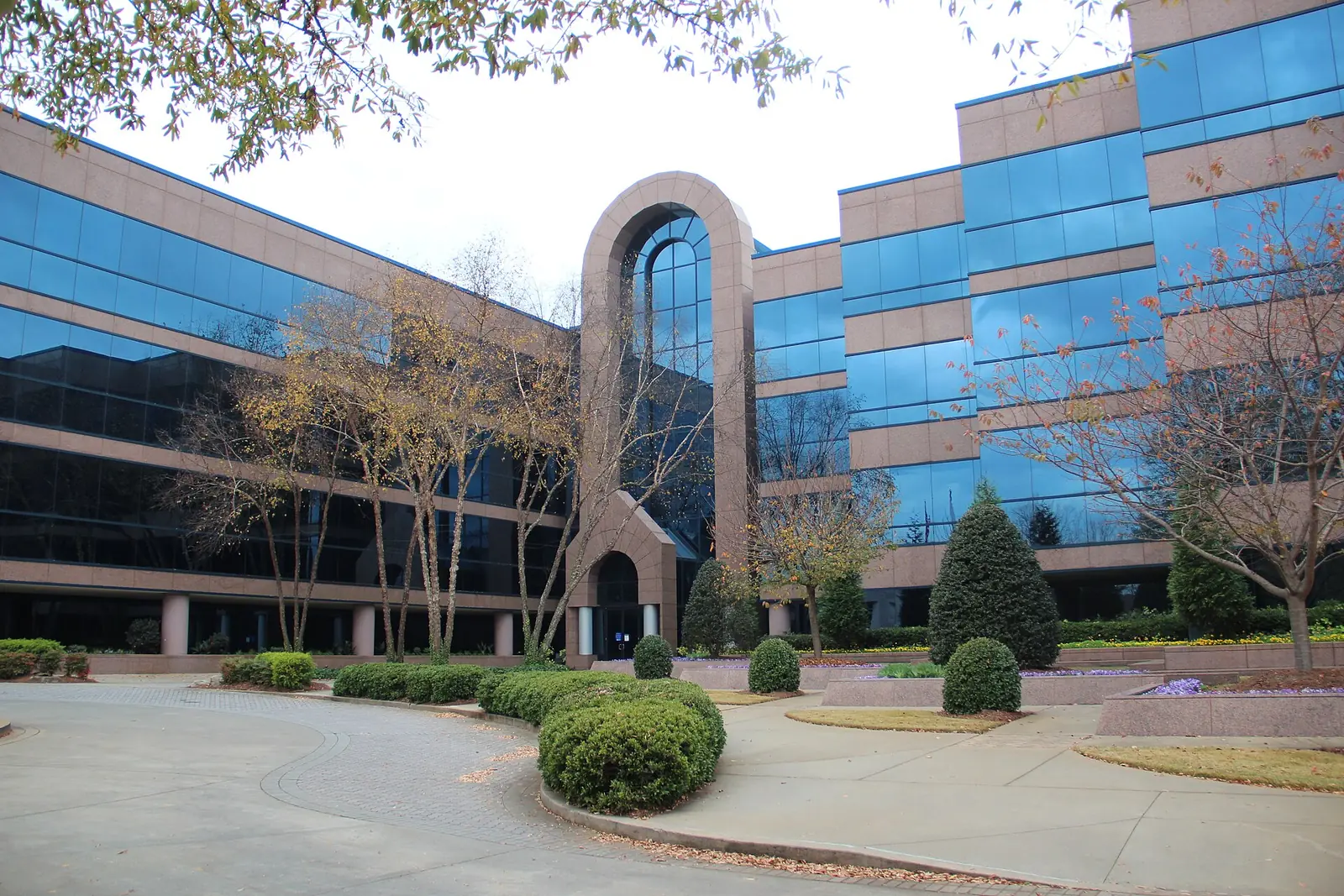
Tech Park, home to Johns Creek City Hall and the Town Center, is in ZIP 30097 and zoned for Northview High. Zillow: $710,739 in August 2026.
Last checked Oct. 5, 2026. Sources: the City of Johns Creek comprehensive plan and its Community Areas map layer, the city’s Boardwalk at Town Center page, Fulton County Schools address map data, the state’s 2025 School Grades data, Zillow Research, MARTA and OpenStreetMap.
Tech Park is the office park at the north end of Medlock Bridge Road that now holds Johns Creek City Hall and the city’s Town Center. It is one of the eight Community Areas in the city’s comprehensive plan and the smallest by population, but the plan says it grew fastest from 2010 to 2022, with subdivisions among the offices, the hospital and a golf club.
What this means for you
- Zoned high school: Northview High for every address in the district’s map data. Check yours with the district’s Find Your School lookup.
- Home value: $710,739 in ZIP 30097 in August 2026, according to the Zillow Home Value Index.
- Nearest Georgia 400 exits: exit 10, Old Milton Parkway, or exit 11, Windward Parkway, each about 7.7 miles by road.
Part of our Johns Creek neighborhoods guide.
Where it is
The comprehensive plan’s Tech Park chapter describes the area as bounded on the north by Forsyth County, on the west by Johns Creek, the stream, on the south by Abbotts Bridge and Bell Roads and on the east by the Shakerag Community Area. The city’s map layer puts it at about 1,052 acres.
Technology Park Johns Creek was developed in the mid-1980s on Findley family farmland at McGinnis Ferry and Medlock Bridge Roads, the plan says, and half of it lies across the county line in Forsyth County. The plan describes more than 500 acres of low- and mid-rise office buildings, stores, subdivisions, The Standard Golf Club, Emory Johns Creek Hospital and city buildings, with businesses employing more than 10,000 people. It counts 2,046 residents in 2022, with population growth of 4.9% a year from 2010 to 2022, the highest in the city.
In 2017 the city bought a 1997 office building and 26 acres with two lakes; the building became City Hall, and the plan called for turning the lakes into a park. The Boardwalk at Town Center now surrounds a pond next to City Hall. The plan names the core of Technology Park as the site of the city’s Town Center and calls for high-intensity mixed use there, generally up to five stories. The city is also building a pedestrian tunnel under Medlock Bridge Road into the Town Center; its project page expected construction to finish in summer 2026.
Every one of the area’s 1,575 address points in the school district’s map data is in ZIP code 30097. Mailing addresses often read “Duluth,” but the area is inside Johns Creek city limits, so the city provides police, fire and road services.
Schools
Of the 1,575 address points in this area in the Fulton County Schools map data on Oct. 5, all are zoned for one middle and one high school. Scores are 2025 College and Career Ready Performance Index (CCRPI) figures from the state’s School Grades report; the state average was 76.9 for high schools.
| Level | School | Share of addresses | 2025 CCRPI |
|---|---|---|---|
| High | Northview High (report card) | 100% | 98.5 |
| Middle | River Trail Middle (report card) | 100% | 96.3 |
| Elementary | Shakerag Elementary (report card) | Split | 99.3 |
| Elementary | Findley Oaks Elementary (report card) | Split | 97.4 |
| Elementary | Wilson Creek Elementary (report card) | Small part | 99.4 |
On the district’s 2025-26 zone map, Shakerag and Findley Oaks split most of the elementary zone, so check the exact address. No public school is inside the area; Northview High is about 1.5 miles south, in a straight line, at 10625 Parsons Road, according to the federal NCES directory. Zone maps for every school: the district’s attendance zones page.
Home values
The typical home value in ZIP 30097 was $710,739 in August 2026, down 0.36% from $713,339 in August 2025, according to the Zillow Home Value Index. The index is a modeled typical value for the middle third of homes, not a sale price. ZIP 30097 covers the whole east side of the city and part of Duluth, so it says little about Tech Park’s homes on their own. The citywide Johns Creek figure was $695,041, up 0.59% on the year. Recent sales are in our weekly real estate transfers.
Parks and trails
The Boardwalk at Town Center, behind City Hall at 11362 Lakefield Drive, open 6 a.m. to midnight. From the city’s Boardwalk page:
- 20 acres next to City Hall along Medlock Bridge Road, between Johns Creek Parkway and East Johns Crossing
- A 15-foot-wide trail around a pond and wetland, about a mile from Johns Creek Parkway north toward McGinnis Ferry Road, with a North Pond loop of about half a mile
- An amphitheater with a deck over the water, terraced seating and plazas; summer concerts are listed on the city site
- Public parking at City Hall, 11360 Lakefield Drive
Bell Boles Park, 10575 Bell Road, and Shakerag Park, 10945 Rogers Circle, are to the east in Shakerag. More in our walking and biking trails guide and our things to do listings for events at the Boardwalk.
Getting around
- Georgia 400: exit 10, Old Milton Parkway, and exit 11, Windward Parkway, are each about 7.7 miles by road from City Hall. Exit numbers are from OpenStreetMap.
- Airport: about 38 miles by road to Hartsfield-Jackson Atlanta International Airport, measured from City Hall on the OpenStreetMap road network with the OSRM routing engine; it is a distance, not a drive time.
- MARTA: no MARTA bus stops are inside the area, according to MARTA’s schedule data. The nearest are route 140 stops in Alpharetta, about 4 miles west in a straight line.
- Main roads: Medlock Bridge Road runs north and south through the area; McGinnis Ferry Road, on the county line, and Abbotts Bridge Road run east and west.
Groceries and everyday stores
From OpenStreetMap:
- Trader Joe’s, McGinnis Ferry Road, inside the area
- Walgreens, Hospital Parkway, inside the area
- Kroger, 3651 Peachtree Parkway, and Sprouts Farmers Market, 3630 Peachtree Parkway, just north across McGinnis Ferry Road, outside the city
How we drew this area
The name, history and boundary come from the City of Johns Creek’s comprehensive plan, and the outline from the city’s Community Areas map layer; you can check an address with the city’s Which Community Area Do I Live In? lookup. School and ZIP shares come from every address point inside that outline in the Fulton County Schools map service, checked Oct. 5, 2026. Store locations are © OpenStreetMap contributors.
Frequently asked questions
Where is Tech Park in Johns Creek?
The city’s comprehensive plan places it in the north center of the city, bounded by Forsyth County on the north, the Johns Creek stream on the west, Abbotts Bridge and Bell Roads on the south and Shakerag on the east.
What high school is Tech Park zoned for?
Northview High, for every address in the area in the Fulton County Schools map data, with River Trail Middle. Elementary zones are split among Shakerag, Findley Oaks and Wilson Creek.
What is the Johns Creek Town Center?
The city’s plan picked the core of Technology Park as the site of a new Town Center around City Hall, 11360 Lakefield Drive, and the 20-acre Boardwalk at Town Center park next to it.
What is the typical home value in ZIP code 30097?
Zillow put it at $710,739 in August 2026, down 0.36% from $713,339 a year earlier. The figure is a modeled typical value, not a sale price.
Have your say